Showing posts with label earth. Show all posts

Thursday, April 30, 2020

Pandemic


Life is funny. Recently I have found a poem which is really inspiring, would like to share with you all:

We fell asleep in one world. and woke up in another.

Suddenly Disney is out of magic,
Paris is no longer romantic,
New York doesn't stand up anymore,
the Chinese Great Wall is no longer a fortress,
and Mecca is empty.

Hugs and Kisses suddenly become weapons, and not visiting parents and friends becomes an act of love.

Suddenly you realize that power, beauty, and money are worthless,
and cannot get you the oxygen you're fighting for.

The world continues its life and it is beautiful.
It only puts human in cages.
I think it's sending us a message:
"Human, you are not necessary.
The air, earth, water, and sky without you are just fine.
When you come back,
remember that Avocado Toast (a millennial popular food) is optional. Not a requirement."

-----Zachary Laid Finding Freedom


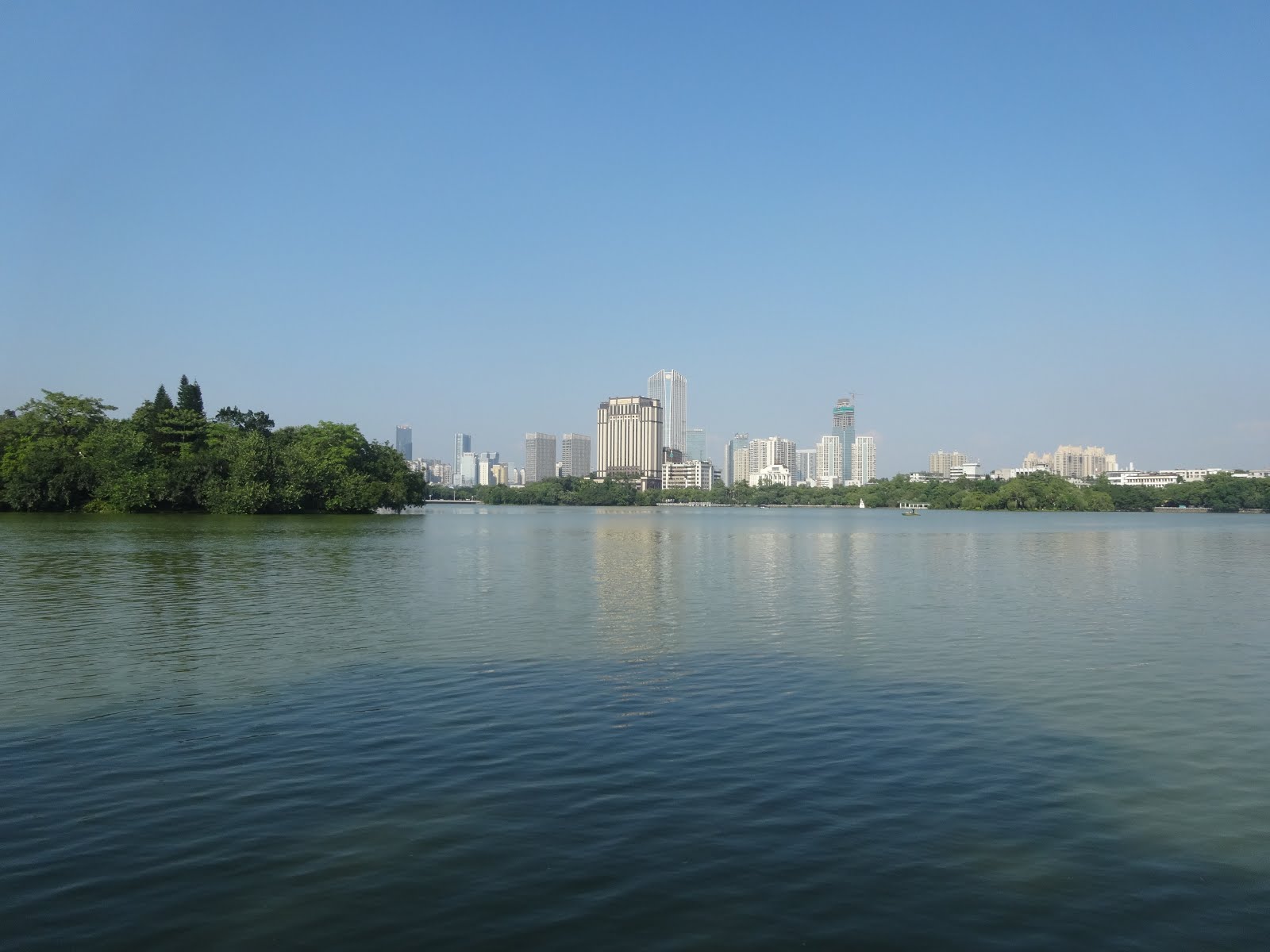
My thought: It's easy for nature to claim her territory back without human interference. We should take this pandemic as a warning to treat the Earth better and realize that nothing is more important than our health. Thanks to this virus, I could enjoy the city without heavy traffic due to temporary shut down of businesses, the cleaner air we could breathe now due to less industrial activities, the wfh lifestyle and new business opportunities. I saw that homeless people are finally taken care of by the city leaders and broken roads are finally getting repaired. Humanity is evolving with the help of technology and this virus. Anyways, I always believe in positivism, crisis creates opportunities! Cheer up, my friends!

Wednesday, August 15, 2018

Don’t be afraid to trust


When you find someone you want to believe and love wholeheartedly, go for it. I’m not saying that you don’t do due diligence. Do your due diligence and trust 100%. At the end of the day, you got nothing to lose. If the person proves that himself/herself worth your trust, you win; if not, you still win, because you have given love to the person without expecting any rewards. That’s the highest practice for love. If that trust costs some money, then so be it, money is nothing but a tool, depending on how we use it. The goal is feeling happy and healthy!

Monday, April 9, 2018

Story Tellers

There’re always two sides of a story so be more understanding and less judgmental.
The purpose of life is to fully extend our potentials and have as few regrets as possible!


Thursday, March 8, 2018

Maturity

Maturity is the ability to accept ambiguity and to postpone gratification - quoted from Sigmund Freud @ Kantaro Sweet tooth Salary Man :)

Friday, November 15, 2013

Travel in 2012 and 2013

Nov 2012 Travel to Nanjing in China


Haven't posted anything here for a long time. And here comes the end of the year again.

I can see myself growing. It's nice to read back what I wrote before. Who cares about this blog. I wonder. I make this public, but I don't really promote it to people. It's been a contradicting need of self-awareness.

I don't expect people around me would read my blog, because I am sure there are so many more important things in their lives that they are more concern about.

If you are the person who is following my blog, thanks for your time! I hope this is helpful and inspiring to you.


July 2013 Road trip:
States Covered:
California
Arizona
Utah
Nevada
Colorado
Wyoming
South Dakota


Sunday, February 19, 2012

I hope I can travel to the happiest countries soon!


世界上最快乐的国家排名

昨天英国智囊机构“新经济学基金会”公布了一项调查结果,他们根据“快乐星球指数”在世界178个国家和地区作了调查,发现南太平洋岛国瓦努阿图是地球上最快乐的国家。真是令人大跌眼镜了。

瓦努阿图是一个南太平洋岛国,以旅游业为主,人口不到21万,人均GDP不超过三千美元,远远低于工业发达国家,也比不上我国一些经济发达的省市。
据介绍,“快乐星球指数”是根据消费水平、国民平均寿命以及快乐满足的程度来评比的,而不是用一般的国民收入或国民生产总值等国家财富指数来评比。评比这项指数的目的是想显示生活好坏与否,不见得与高消费水平有关。换句话说,快乐与否跟有没有钱没有直接关系。


先来看一下全球最快乐的10个国家1.瓦努阿图,2.哥伦比亚,3.哥斯达黎加,4.多米尼加,5.巴拿马,6.古巴,7.洪都拉斯,8.危地马拉,9.萨尔瓦多,10.圣文森特和格林纳丁斯。

调查结果显示,生活在富裕国家的人并不见得很快乐,请看一下八国集团成员的排名:66.意大利,81.德国,95.日本,108.英国,111.加拿大,129.法国,150.美国,172.俄罗斯。

欧洲方面,前三位的排名分别是:61.奥地利,64.冰岛,65.瑞士。最后三位的排名为:172.俄罗斯,173.爱沙尼亚,174.乌克兰。它们都是前苏联的加盟共和国,这个调查显示,从前苏联解体出来的国家大都排名偏后。

亚洲方面,排名最前的是越南,排在第12位,其它国家和地区分别为:17.菲律宾,23.印度尼西亚,31.中国,32.泰国,44.马来西亚,62.印度,84.台湾,88.香港,95.日本,102.韩国,112.巴基斯坦,131.新加坡。中国排名比较靠前,把日本和“四小龙”都比下去了。

再看一下全球最不快乐的10国家:169.土库曼斯坦,170.赤道几内亚,171 .莱索托,172.俄罗斯,173.爱沙尼亚,174.乌克兰,175.刚果,176.布隆迪,177.斯威士兰,178.津巴布韦。
从上面的排名看出,排在前10位的国家都是小国家,大部分在美洲,剩下的是岛国,他们不算贫穷,但也谈不上富裕,他们既没有中东国家丰富的石油资源,也没有北欧国家良好的福利制度,更没有八国集团强大的生产力,但他们却是全球最快乐的国家。再看看排名最后的10个国家,其中6个是非洲贫困国家,4个是前苏联加盟共和国。这一切说明了什么?如果说富裕未必能使人快乐的话,那么贫困和剧变就更容易使人忧愁。最后想请教一下各位:人若想快乐,到底需要些什么?


资讯
  位置:位于太平洋西南部,地处澳大利亚布里斯班以东1750公里,斐济以西800公里。
  签证:目前中国公民赴瓦不需要签证(出发前最好与瓦努阿图驻华使馆进行确认),但由于尚未开通直航,经由澳大利亚或斐济等国转机时需申请该国的过境签证。
  气候:南部为亚热带、北部为热带海洋性气候,年平均温度25.3℃。季节与北半球相反。11月至4月为雨季,平均气温为28℃。5月至10月为干季,平均气温为23℃。
  如何到达:中国与瓦努阿图之间尚未开通直航航线,可通过澳大利亚、斐济、新西兰、新喀里多尼亚转机前往。
  货币及汇率:法定货币为瓦图(V a t u),缩写为V T。(1U S$=99V T,1J P¥=0.78V T)。在市内、机场的银行及酒店均可兑换外币。商业银行有Bank ANZ, Westpac等。
  饮食:美拉尼西亚风格。当地特色食品有拉普拉普、椰子蟹。在维拉港市区能吃到法国、英国、波利尼西亚及中国、日本、越南等地料理。本地啤酒为T u r s k y。自来水可直接饮用。但在外岛最好饮用市贩的矿泉水。
  特色饮品:卡瓦几千年前就已经出现在南太平洋,是将一种胡椒科植物的根部捣碎,经煎熬提炼出成分制成的饮品。过去一度只有酋长们独享,现在这种传统饮料已经成为当地人生活的一部分,有时也作为止痛和治病的良药。在一天的辛劳之后,两三杯卡瓦下肚,所有压力与烦恼都一扫而空。瓦努阿图的卡瓦据说是最冲的。卡瓦的色相接近于北京的豆汁,味道类似苦涩的中药。饮用卡瓦应在下午或傍晚。旅行者很难找到nakamals(卡瓦吧),可请出租司机带路或询问酒店职员。在维拉港,通常一杯的价格在100-150瓦图,初次品尝者切勿过量。在摊拿岛,女性被禁止喝和接近卡瓦。
  购物:维拉港是瓦努阿图惟一的免税港口,在市中心海滨大道上有免税品商店。瓦努阿图本土风格的商品:草编的背包、垫子、木雕、面具、发饰等饰物、陶器、模仿仪式道具制作的工艺品及民族服装等。
  娱乐项目:游泳、潜水、浮潜、皮划艇、帆板、香蕉船、独木舟、玻璃船观光、游艇巡游、喷气式快艇、钓鱼、深海捕鱼、高尔夫、网球、骑马、丛林探险、直升飞机探险。
  礼仪禁忌:
  没有收取小费的习惯。在瓦努阿图,小费和乞讨都被认为是不文明的行为。
  拍照时(尤其在村子里)最好先征得许可。外岛居民很少穿着透明质地的服装,在民俗村和观光地以外的地方尽量避免暴露的衣着。
  在进入村庄之前,应先征得村人的许可。直接去敲住家的门被视为不礼貌的行为。
  在路边生长的蔬菜、水果等植物,大多为别人的私有财产,切勿随手采摘。
  国内交通:
  1.维拉港的出租车不按计价器行驶,乘车前一定要与司机充分确认价格。事先打听好行情是很必要的。面包车是当地人的主要交通工具,类似从前的“面的”,也是招手即停,价格要比出租车便宜许多。
  2.租车:维拉国际机场设有AVIS、Budget等大型租赁公司的柜台。租车的基本条件为年龄在25岁以上拥有国际驾驶执照者。Discount Rentals提供半日的汽车租赁,价格由4000瓦图起。在第二大城市卢甘维尔(Luganville)也有汽车租赁服务。


Reference:


http://ngmchina.com.cn/web/?action-viewnews-itemid-26664


http://www.greenhousechina.com/bbs/showthread.asp?threadid=208


Friday, November 19, 2010

Lab 7: Station Fire and My Map Interpretation


The Station Fire extended northwards and in uphill direction. When I researched from Wikipedia, I am shocked to know that the fire was the largest and deadliest of the California wildfires in 2009, burning 251 sq miles. The Station Fire burned on the slopes of Mount Wilson, threatening numerous television, radio and cellular telephone antennas on the summit, as well as the Mount Wilson Observatory. It started in the Angeles National Forest near the U.S. Forest Service ranger station on the Angeles Crest Highway. The blaze threatened 12,000 structures in the National Forest and the nearby communities of La Cañada Flintridge, Glendale, Acton, La Crescenta, Littlerock and Altadena, as well as the Sunland and Tujunga neighborhoods of the City of Los Angeles (Wikipedia).

My hypothesis for this incident is that fire tends to move towards uphill direction. As we can see from the temporal pattern from August 29 to September 2 on the map above, the fire expands its size from the lower to upper elevation. This can be proved by the hillshade which provides us a visualization of the slopes and aspects. One possible reason for the upward movement of the fire is that warm air and gas tend to rise. It is because they have lower density and thus less heavy. Besides lower density of warm air, the dry weather of California also facilitates extension of fire.  
In addition, the fire happened next to the network of highway. Thus, there might be a chance that a driver threw out his or her used cigarette from the car, which burned the nearby dry vegetation and caused the fire. Moreover, Relief work for the people who are suffered from the fire would be convenient. It is because there are lots of hospitals and freeways around the area. 
According to the map, I also indicate that the fire covered Angeles National Forest and some LA country parks. This implies that the fire damage lots of vegetations. Therefore, it caused tremendous environmental detriment. According to the U.S. Department of the Interior, "the secondary effects of wildfires, including erosion, landslides, introduction of invasive species, and changes in water quality, are often more disastrous than the fire itself." Lost vegetation and exposure of bare ground increase the risk of flooding and debris flow. "Sediment, burned debris, and chemicals affect water quality" (Suite101).
Furthermore, wildfires worsen air quality. When inhaled, smoke and ash can cause negative and lasting health effects, including lung disease. On the other hand, wildfires may have some environmental advantages. The Department of the Interior mentioned that "Many species depend on wildfires to improve habitat, recycle nutrients, and maintain diverse communities." However, the destructions related to the fire outweigh benefits. The chemicals used to battle fires are also perilous to natural world (Suite101).


Works Cited
2009 California Wildfires. Wikipedia. 1 November 2010. 25 November 2010.    <http://en.wikipedia.org/wiki/2009_California_wildfires>

Map Share. UCLA. 18 February 2009. 25 November 2010. <http://gis.ats.ucla.edu//Mapshare/Default.cfm>

Maps & GIS. Los Angeles County Department of Regional Planning. 2009. 25 November 2010. <http://planning.lacounty.gov>

Parent, Jason. “North American Wildfire-Causes and Prevention.” Suite101.com. 3 September 2009. 25 November 2010. <http://www.suite101.com/content/north-american-wildfires-causes-and-prevention-a144814#ixzz15lkuJoS3>

The National Map Seamless Server. USGS. 30 September 2010. 25 November 2010. <http://seamless.usgs.gov/website/seamless/viewer.htm>


Friday, November 5, 2010

Lab 5 Projections in ArcGIS


           Map projections are significant to portray the surface of the earth or a portion of the earth on a flat surface. There are three main types of projections, which are conformal, equal area, and equidistant. They are based on distortions of conformality, distance, direction, scale, and area. Distortions of these properties are minimized by specific map projections at the expense of making errors in other aspects. For instance, in conformal map projection, the scale of a map at any point on the map is the same in any direction. Meridians and parallels intersect at right angles. Shapes as perfect circles are preserved locally on conformal maps. In this assignment, I quote Mercator as an example of conformal maps. The Mercator projection has straight meridians and parallels, which intersect at right angles. Scale is true at the equator or at two standard parallels equidistant from the equator. The projection is often utilized for marine navigation because all straight lines on the map are lines of constant azimuth. Another example for conformal map projection is Stereographic. Stereographic projections are applied for navigation in Polar Regions. Directions are true from the center point.
             As for equal area map projection, a map portrays areas over the entire map so that all mapped areas have the same proportional relationship to the areas on the Earth that they represent. An example is Sinusoidal equal-area maps. They have straight parallels at right angles to a central meridian. Scale is true only on the central meridian and the parallels. The maps are often employed in countries with a larger north-south than east-west extent. Last but not least, equidistant maps are important for portraying distances from the center of the projection to other places on the map. For example, equidistant conic and equidistant cylindrical maps distort direction, area, and shape away from standard parallels. They are used for portrayals of areas near to the equator.
              One of the advantages and potentials of using map projections is that they are easy to be used. It is because the only way to get an exact duplication of the Earth is to project the globe from a three dimensional planet to a two dimensional plane. The two dimensional representation is easier to be carried around for the study of geographical information. Another potential of map projections is for commuting and traveling. We can easily collect crucial data to strengthen our understanding of the relationships between places on the Earth. For instance, equidistant conic projections preserve distances on the earth so they are useful for showing directions when commuting. This preservation assists travelers to estimate the resources they will need, such as traveling distance, gas, and time, to efficiently commute between two locations. Consequently, we can make good use of different map projections according to our specific researching purposes. For example, the equal-area Mollweide projections may help researchers to map the areas of urbanization because vicinity is preserved.
             However, map projections have pitfalls and perils. The basic problem inherent in any type of map projection is that it will result in some distortion of the ‘ground truth’ of the area being mapped. As we can see in the figure above, large objects in the projection are distorted in the Mercator projection, while Antarctica becomes a huge land mass covering almost half the map.There are four basic characteristics of a map that are distorted to some degree, depending on the projection used. These characteristics involve distance, direction, shape, and area. The only place on a map where there is no distortion is along the trace of the line that marks the intersection of our ‘paper’ with the surface of the earth. Any place on the map that does not lie along this line will suffer some distortion. Therefore, different map projections provide inconsistent information about distance, direction, shape, and area. Essentially, by looking at the Mercator projection, I measured that the distance between Washington D.C. and Kabul is around 10,000 miles while it is only around 5000 miles in the equidistant cylindrical projection.  The equidistant cylindrical projection is more reliable because it preserves distances between points on the earth, whereas the conformal Mercator does not preserve distances. Users may get confused if they do not understand the preserved properties of different map projections. Fortunately, depending on the type of projection used, at least one of the four characteristics can generally be preserved. As a result, we should remember to make sure that we are using the right map projection to collect geographical information. If we choose the wrong one, inaccurate data will be found, which will adversely affect our interpretation and analysis of the data. Therefore, we should identify the correct maps and understand their potentials and pitfalls before using them.


Friday, October 15, 2010

Lab 3: Create my own map =) Fun Eastern Washington Road Trip


View Fun Eastern Washington Road Trip in a larger map


      As for the potential of neogeography, online interactive maps assists to extend information rapidly and straightforwardly. User-created maps are well-organized methods of assigning important information to people who dislike a paper maps. Moreover, neogeography lets us share our individual analysis of the same geographical area. The individualized maps also add a social understanding of the vicinity. However, this extensive data source holds some risks according to how the data is explained and applied. 
      Because these types of maps can be edited with no trouble and they look proficient, they may endow with misinformation. People would be misinformed into trusting the wrong data. Furthermore, the fact that the advanced programming does all of the thinking for the users may lead to a dilapidation in users’ investigative skills. Another drawback of neogeography is a threat to privacy and security. Neogeography allows for an exchange of personal information among the crowd, such as sexual orientation and political alliance. This implies that people can be targeted for crimes. Last but not least, if we over-rely on online maps, we may get lost if the area does not have internet access on the way of our trips. Therefore, paper maps are still worthwhile and reliable to be used in addition to google or yahoo maps.